
Wanderung Fanellhorn 20.08.2018
Das Fanellhorn ist in den Adula-Alpen südlich von Vals im Valsertal im Kanton Graubünden. Die Wanderroute startet in Zervreila und über Weiden führt bis zu Guraletschseen am Fuss von Guraletschhorn. Dann weiter über Geröllfelder bis zu Fanelllücke auf dem Fanellgrätli und schliesslich über den Ost-Grat und SO Flanke auf den Gipfel. Es ist eine ziemlich lange Wanderung mit 1300 Hm und mehr als 10 km.
 Die Route |
 Höhenprofil |
 3 of 23 Gut sichtbare Markierung  Gut sichtbare Markierung |
 4 of 23 Über die Weiden Richtung Guraletschsee Über die Weiden Richtung Guraletschsee |
 5 of 23 Guraletschseen Guraletschseen |
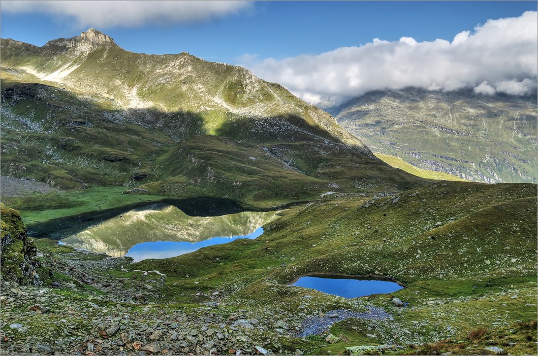 6 of 23 Guraletschseen und Bleschatura Guraletschseen und Bleschatura |
 7 of 23 Wie lange bleibt noch oben Wie lange bleibt noch oben |
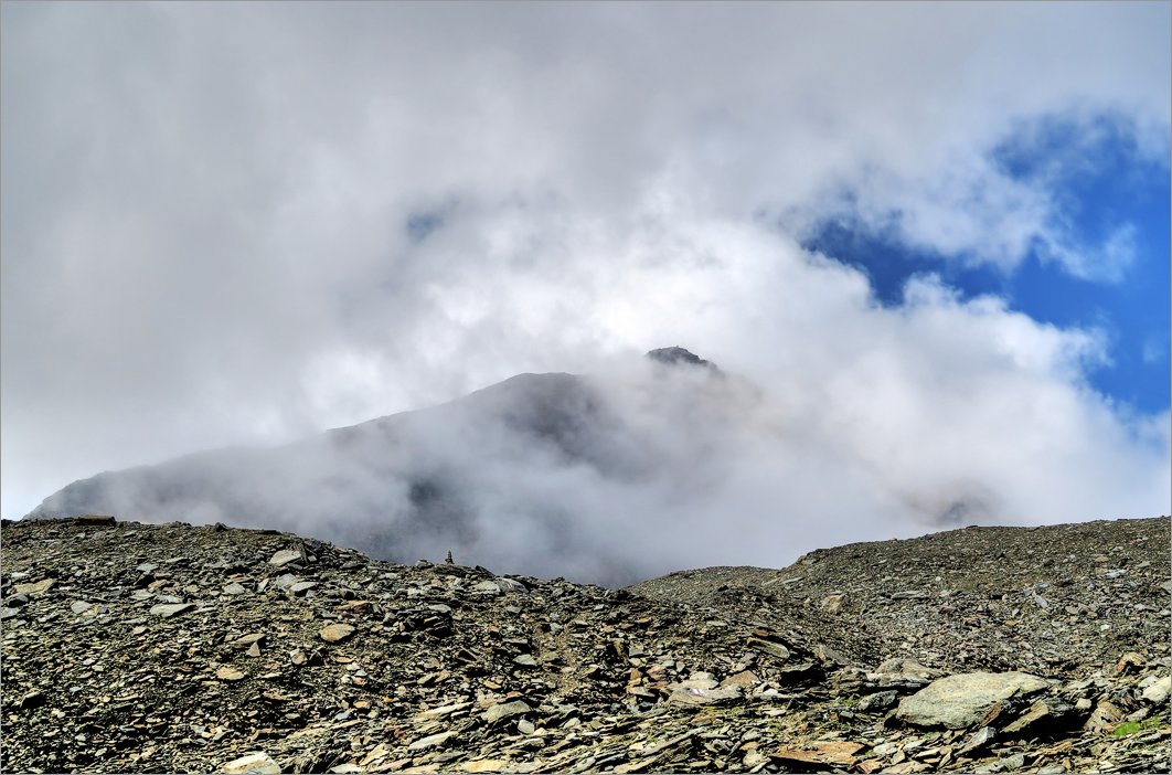 8 of 23 Fanellhorn in den Wolken Fanellhorn in den Wolken |
 9 of 23 Fanellhorn Fanellhorn |
 10 of 23 Fanellhorn von Fanelllücke gesehen Fanellhorn von Fanelllücke gesehen |
 11 of 23 Lange SO Flanke von Fanellhorn Lange SO Flanke von Fanellhorn |
 12 of 23 Auf dem Gipfel. Es gibt kein Gipfelkreuz Auf dem Gipfel. Es gibt kein Gipfelkreuz |
 13 of 23 |
 14 of 23 Guraletschsee von Fanellhorn aus Guraletschsee von Fanellhorn aus |
 15 of 23 Die Umliegenden Gipfel sind leider von Wolken bedeckt Die Umliegenden Gipfel sind leider von Wolken bedeckt |
 16 of 23 Es ist bewölkt Es ist bewölkt |
 17 of 23 Blick Richtung Fanelllücke. Peiltal rechts führt nach Vals Blick Richtung Fanelllücke. Peiltal rechts führt nach Vals |
 18 of 23 Chilchalphorn Chilchalphorn |
 19 of 23 Fanellhorn im Abstieg Fanellhorn im Abstieg |
 20 of 23 Auf dem Fanellgrätli Auf dem Fanellgrätli |
 21 of 23 Fanellhorn Fanellhorn |
 22 of 23 Blick Richtung Vals Blick Richtung Vals |
 23 of 23 Zervreilasee Zervreilasee |
Datum
20.08.2018Ziel
Fanellhorn (3124m), ► siehe auf der Karte .Koordinaten
WGS 84 (lat/lon): 46.547783, 9.130475CH1903 / LV03: 729750, 156564
Region
Kt. Graubünden, ValsertalAusgangspunkt
ZervreilaHoehenmeter
ca. 1300mStrecke
11kmSchwierigkeit
T3Karten
► map.geo.admin.chHerunterladen
► GPS Track als kml-File (mit rechten Maustaste "Save Link/Target as").Sonstiges
Fanellhorn in Wikipedia:Das Fanellhorn ist ein Berg in den Adula-Alpen südlich von Vals im Valsertal im Kanton Graubünden in der Schweiz mit einer Höhe von 3124 m. Nördlich vorgelagert befinden sich das Ampervreilhorn und das Guraletschhorn. Mit diesen beiden bildet das Fanellhorn einen in Nordsüdrichtung verlaufenden Bergkamm, der das Valsertal in die zwei Nebentäler Peilertal und Zervreilatal trennt. Westlich des Fanellhorn befindet sich der Zervreilasee. Nach Westen bricht das Fanellhorn mit einer 400 m hohen Felswand hin ab und bildet eine formschöne Pyramide. Über die Nordflanke kann das Fanellhorn unschwierig über eine weiss-blau-weiss markierte alpine Route bestiegen werden. Im Winter ist das Fanellhorn ein beliebtes Skitourenziel.